Page Content
The Perfume/Incense route from Petra to the west, through the Israeli Negev to the port of Gaza by the shore of the Mediterranean, stretches across some 150 kilometers. This route was approved, recognized and acknowledged as a world heritage route since 2005 by UNESCO.
Among the famous fortresses and cities along this route were Petra, Moa, Khan Saharonim, Avdat, Mamshit, Shivta and Halutza, which are described in detail below.
Some of these sites contained, in their prime, villas, shrines, churches, bath houses, water pools for collecting water, water springs, wineries and cemeteries. Agriculture was developed in some of them and many included cultural activities which enabled the inhabitants to be relatively self-sufficient.
Petra
The city of Petra was built by the Idumaeans in the 9th century BCE and was conquered by the Nabataeans some 600 years later. The Nabataeans made it their capital and it served as one of the main stations in the perfume route.
Famous for its magnificent structures that are carved into its red rocks, Petra is located approximately 885 meters above sea level and is locked between mountains with only one entry through a high walled narrow canyon at the east.
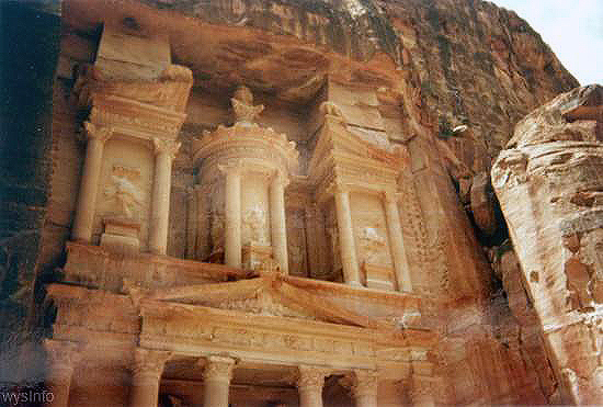
In 104 CE it was taken over by the Romans and their influence is reflected in the archaeological remains. Today Petra is considered as one of the ‘7 Wonders’ of the world.
Moa
Moa was built by the Nabataeans some time in the 3rd century BCE and remained populated for about 500 years.
While not readily apparent today, Moa once served as a resting station for the convoys that came from Petra in the east, on their way west to Gaza on the shore of the Mediterranean.
It was also located on the road that led to a town, by the Red Sea, where the modern city of Eilat now sits. Thus, once again, its importance derived from being located at a cross road.
Moa contained a fortress, accommodations for the convoys, an industrial zone, agricultural fields and, what was most important and crucial for the convoys on their long journey, it had water. It included a pool, aqueduct and baths.
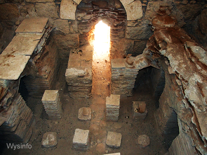
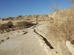
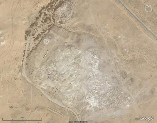
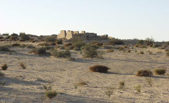
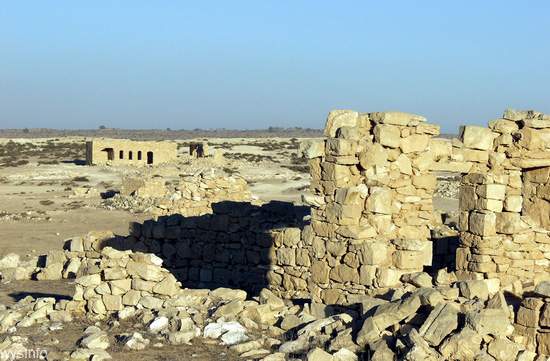
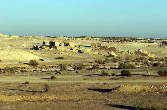
Khan Saharonim
The Khan – a caravanserai (an inn in the desert) – was built by the Nabataeans by the end of the 1st century CE. It served as a resting and guarding station along the spice and incense route, between Moa and Avdat.
The main structure was 45 by 45 meters and can still be seen in the site. In the center of the structure there was a courtyard that was surrounded by rooms.
Rooms surrounding courtyard of Khan Saharonim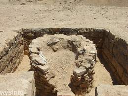
Ancient Oven in main structure of Khan Saharonim
The main source of water for the Khan guards and the convoys was a spring of water that fed into a wadi, rich in natural vegetation, located some 100 meters from the site.
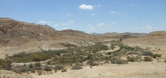
Today, the water no longer flows at the surface level along the wadi, most probably due to an earthquake that occurred some digging with their feet to expose the water for drinking.
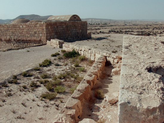
The Khan remained in use after the annexation of the Nabataean kingdom by the Roman Empire in 106 CE and remains of Roman signposts, pointing directions for the ‘Incense Route’, are still standing along the ancient road, not far from this site.
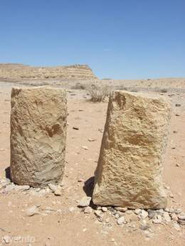
Roman posts marking the incense route between Khan Saharonim to Avdat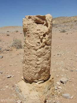
Roman post marking the incense route between Khan Saharonim to Avdat
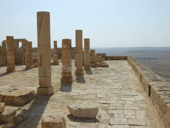
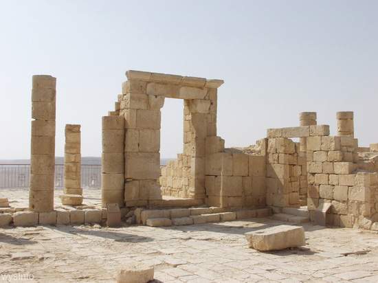
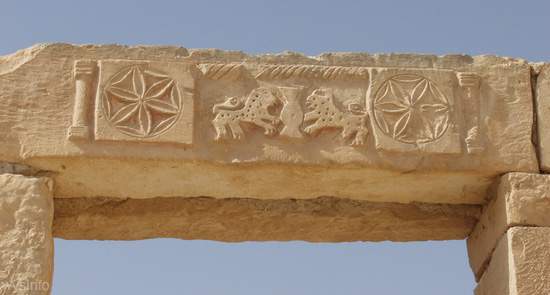
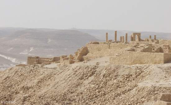
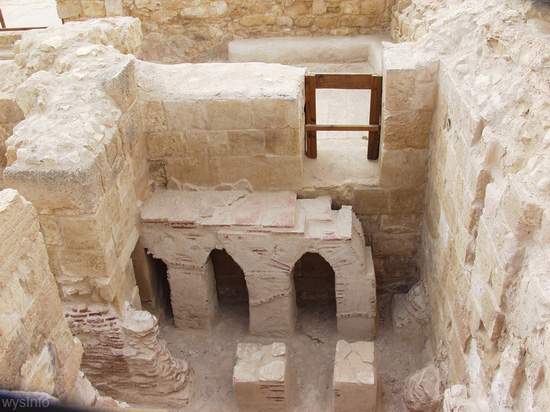
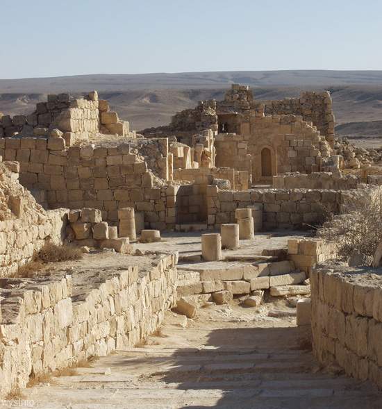
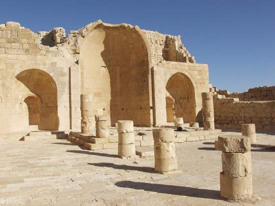
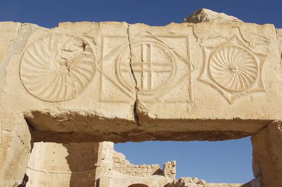
Avdat (or Ovdat)
Avdat was also located along the ancient Incense Route that stretched from Petra to Gaza.
It was deserted at the beginning of the 1st century BCE, following the conquest of Gaza by the Hashmonian King Alexander Yanai.
The city was revived by the Nabataean King Aboda the 2nd in the middle of the 1st century BCE and was named after him. He was the only Nabataean king that was thought of as a God and was buried, at his request, in this city.
The city kept on flourishing after the Romans took it over around 106 CE, and then declined only after the Arab conquest in the middle of the 7th century.
The center of the city is located on a hill some 650 meters above sea level and there one can find the most impressive structures.
The remains of the city include:
- A production house for pottery
- A winery
- Roman defensive towers
- Halls
- Churches from the 4th century
- A Roman bath house for cold medium and hot baths
- Army camps
- Water systems
- Warehouses and burial caves
This city is mentioned in the writing of Talmai, The Greek Geographer from the 2nd century. The city also appears in Poitinger’s map from the 5th century CE and some papyrus writings, found in Nitzana, claim that Avdat was supported economically and militarily as a frontier city.
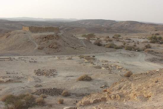
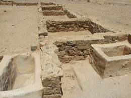
Mamshit (Memphis)
The city of Mamshit was built by the Nabataeans in the 1st century BCE.
The city served as a station on the secondary road of the Incense Route. This road went down from Petra and the mountains of Idumea (Edom) to the Arava in the East, up to the scorpion trail and then kept on north to Hebron and Jerusalem or west to Beer Sheba and to Gaza by the Mediterranean.
The size of the City was about 40 dunams and, although the smallest station, it is actually the most preserved out of all the cities from that period in this area. After the Roman conquest and the decline in merchandising, the inhabitants started to breed Arabian horses.
In addition to two churches, there are remains of frescoed wall paintings that include a depiction of the myth of Eros and Psyche, dating back between the end of the second century and the early third century ADE. These frescoes are a rare example of paintings from the Nabataean period.
The city appears in the mosaic floor of Midba, which describes Israel in the Byzantine period. The city was supported by the Byzantines as a frontier city until funds were stopped by the ruler Justinian. By the time of the Arab Conquest in 636 ACE, the city had died out. It was declared as a world heritage site by UNESCO in June 2005.
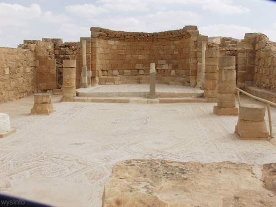
Shivta
It is believed that Shivta was created by the Nabataeans some time in the 1st century BCE.
Unlike other cities of that period, this city was built without protecting walls around it. It was not located along the main trade route and today it is still a fair distance off any main road in Israel, lying between what is now Nitzana and Sde-Boker.
Shivta started as an agricultural village, some 350 meters above sea level and was one of a few settlements created by the Nabateans for that purpose. It had no natural springs but had a water system that was based on collection of rain water into pools
It was conquered by the Romans around 106 CE. By the time of the Byzantine period (the fourth century CE), the Nabataeans of Shivta were already Christians, with a population that reached over 2000 inhabitants.
Church in Shivta – A Station of the Perfume Route
Three churches have been found there and a Mosque that is dated to a later period. Remains of wineries, dams, water collection pools, monks’ cells and basins that provided water and food for animals and horses can be found there. It was deserted some time in the middle of the 8th Century.
In 2005 it was declared by UNESCO, together with Avdat, Mamshit (Memphis) and Halutza as a world heritage site.
Halutza (Elousa, Elusa)
The city, second in importance to Petra, was built by the Nabataeans in the 2nd century BCE. It was located in the northern Negev in Israel in an area that is surrounded by sand dunes and it stretched in size to about 1000 Dunams (approximately 250 acres).
It’s distance from Avdat was about 40 km (24 miles), and from Jerusalem about 71 miles. Although it is not the ideal place to build a city, the fact that underground water was relatively easy to access, and the benefits of the location between Avdat and Gaza, seemed to convince the Nabataeans to settle there.
Halutza is mentioned in many early writings such as those by Claudius Ptholomeus in the 2nd century CE. It is also marked in the Midba Map and is mentioned in writings of Antoninus from Plakantia in the 6th century as well as others.
The earliest known writings from the Nabataean period, dated to 168 BCE, were found there, in which it is said:
“This is the place that did Natiro [was built by Natiro], during the life of Hartat the king of the Nabataeans”.
Although many archaeological excavations of the city have been undertaken, it is believed that most of the city is still buried under the sand of the desert.
Quite a few of the structures in the city were destroyed at the end of the Ottoman period. Nevertheless it is still clear that this large and impressive city included towers, magnificent buildings, baths, mausoleums, theaters, water systems, and kilns for the production of pottery.
It is apparent from Lyvinius’s letters, from the 4th century, that it also served as the administrative city for the whole area. Halutza, too, like it’s sister stations along the incense route, was defined by UNESCO, as a world heritage site.
Ancient Gaza
Gaza, due to it’s location by the shore of the Mediterranean, was a strategic port at the end of the incense and perfume trade route. It played an important role in the connection between Egypt, in the south, to Damascus and Mesopotamia in the north. For the incense convoys that were coming from the east it served as a gateway to Rome and Greece in the west.
It was created by the Canaanites and was later populated around the 12th century B.C.E by the Philistines, a non-Semitic nation (not to be confused with the contemporary Palestinian Arabs – who are Semites). The Philistines were a seafaring people who originally came from the island of Crete in the Mediterranean.
The Philistines founded 5 principalities along the east-south shore of the Mediterranean: Ashkelon, Ashdod, Ekron, Gath and Gaza. Gaza resisted the Israelite conquest by Jonathan the Maccabee until 150 B.C.E, and later was under Herodian rule (1st century B.C.E.). It was rebuilt under the Roman influence of the 1st century CE and some 300 years later it became a center for the new religion of Christianity. Jewish life flourished there during the 5th century C.E. and remains of a synagogue have been found. The Muslims conquered the city around 630 CE.
Layers of remains associated with the Canaanite, Jewish, ancient Egyptian, Persian, Roman, Crusader, Turkish and British periods have been exposed in the surrounding area.
For more information the ancient perfume and spice route crossing the middle east, visit our page on the Ancient Perfume Route.
***
You can find our videos on the Wysinfo Youtube channel.